Maps relating to Ludworth Clay Workings : 1874 -78
Dublin Core
Title
Maps relating to Ludworth Clay Workings : 1874 -78
Description
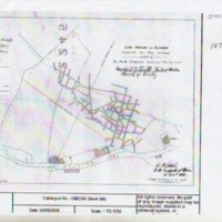
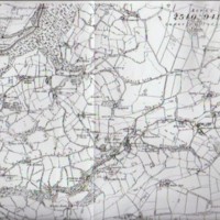
Two photocopies of maps showing Ludworth Clay Workings and Ludworth Brick & Tile Works off Hollins Lane.
a. Section of Lord Howard of Glossop map from 1888 showing the clay workings of North Derbyshire Brick & Tile Company
b. Section of the 1896 ordnance survey map showing Cheshire/Derbyshire border on A3 paper, showing brickworks at Mill Brow
a. Section of Lord Howard of Glossop map from 1888 showing the clay workings of North Derbyshire Brick & Tile Company
b. Section of the 1896 ordnance survey map showing Cheshire/Derbyshire border on A3 paper, showing brickworks at Mill Brow
Date
Reviewed AB 03/2024
Identifier
MRS/02/07
Louiset
Louiset
Collection
Citation
“Maps relating to Ludworth Clay Workings : 1874 -78,” Marple Local History Society Archives, accessed April 23, 2024, https://marplelocalhistorysociety.org.uk/archives/items/show/2415.

