Maps, Plans and Photographs : The Old Vicarage, Mellor
Dublin Core
Title
Maps, Plans and Photographs : The Old Vicarage, Mellor
Description
Several documents relating to the Old Vicarage, Mellor :
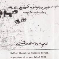
1. Hand drawn map on card showing Mellor Chapel in Glossop parish and surrounding buildings taken from a portion of a map dated 1585.
2. Hand drawn plan of the Old Vicarage from 1836 map.
3. Photocopy of part of the 1836 Tithe map enlarged showing Mellor Church and Vicarage.
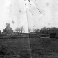
4. Photocopy of the oldest known photo of Mellor dated 1880, showing new school, old school, church, Vicarage, Hearse House and Church Inn.
5. Hand drawn plans of buildings around the Vicarage from 1836 Tithe Map.
Date
Reviewed AB 12/2022
Identifier
PRO/05/01
Louiset
Louiset
Collection
Citation
“Maps, Plans and Photographs : The Old Vicarage, Mellor,” Marple Local History Society Archives, accessed April 27, 2024, http://marplelocalhistorysociety.org.uk/archives/items/show/1458.

