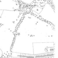
1934 Map of Estate
Dublin Core
Title
1934 Map of Estate
Description
Photocopy of map from 1934 showing Marple Hall Estate, buildings and parkland. Note from exhibition stating slow growth of Marple during 1886 - 1924 and continued sale by the Isherwoods of parcels of land for development.
Date
Reviewed AB 02/2023
Identifier
MAH/012/04
Louiset
Louiset
Citation
“1934 Map of Estate,” Marple Local History Society Archives, accessed December 4, 2024, https://marplelocalhistorysociety.org.uk/archives/items/show/112.
