Holly Vale Mill, Mill Brow : Sketches of Mill, Waterwheel & location Maps
Dublin Core
Title
Holly Vale Mill, Mill Brow : Sketches of Mill, Waterwheel & location Maps
Description
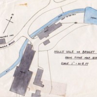
Several hand drawn sketches of Holly Vale or Bridget Mills. These show the layout of the mill, work cottages, yard, mill pond and leat, from the tithe map of 1839.
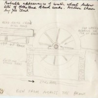
Also a pencil sketch of the probable appearance of the waterwheel at Holly Vale below the site of Holly Head Bleach Works, position shown by Joe Clarke, drawn by Tom Oldham .
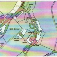
Photocopies of OS and tithe maps showing location of Holly Vale Mill at Mill Brow.
Also a pencil sketch of the probable appearance of the waterwheel at Holly Vale below the site of Holly Head Bleach Works, position shown by Joe Clarke, drawn by Tom Oldham .
Photocopies of OS and tithe maps showing location of Holly Vale Mill at Mill Brow.
Date
Reviewed AB 03/2024
Identifier
MRS/04/01
Louiset
Louiset
Collection
Citation
“Holly Vale Mill, Mill Brow : Sketches of Mill, Waterwheel & location Maps,” Marple Local History Society Archives, accessed December 22, 2024, https://marplelocalhistorysociety.org.uk/archives/items/show/2451.


