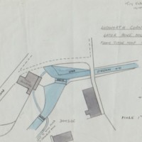
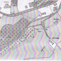
Ludworth Corn Mill : Maps & Plans by Tom Oldham
Dublin Core
Title
Ludworth Corn Mill : Maps & Plans by Tom Oldham
Description
Hand drawn sketch of Ludworth Corn Mill, later Bone Mill from the 1839 tithe map by Tom Oldham also drawings and maps relating to the Corn Mill and its location in the Mellor Area.
Date
Reviewed AB 03/2024
Identifier
MRS/04/06
Louiset
Louiset
Collection
Citation
“Ludworth Corn Mill : Maps & Plans by Tom Oldham,” Marple Local History Society Archives, accessed December 22, 2024, https://marplelocalhistorysociety.org.uk/archives/items/show/2456.

