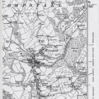
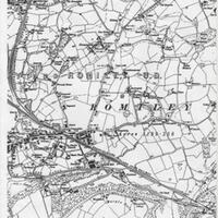
1899 Map of Romiley/Compstall Area
Dublin Core
Title
1899 Map of Romiley/Compstall Area
Description
A3 photocopy of a 1899 map of Romiley and Compstall area, with Peak Forest Canal and Sheffield & Midland Joint Railway and surrounding farmland.
Date
Reviewed AB 09/2022
Identifier
Louiset
CAN/03/08
CAN/03/08
Hyperlink Item Type Metadata
URL
See Hyperlink below from MLHS website relating to Romiley Folds area.
Romiley Folds - Marple Local History Society
Romiley Folds - Marple Local History Society
Collection
Citation
“1899 Map of Romiley/Compstall Area,” Marple Local History Society Archives, accessed December 22, 2024, https://marplelocalhistorysociety.org.uk/archives/items/show/364.

