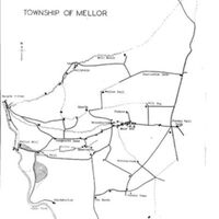
Map of the Township of Mellor
Dublin Core
Title
Map of the Township of Mellor
Description
Hand drawn map of the Township of Mellor, showing prominent houses / roads and rivers from Robin Hood's Picking Roads in the north to Windybottom and The Banks in the south, Marple Bridge in the west to Jordan Wall Nook in the east.
Date/artist unknown.
Date/artist unknown.
Date
Reviewed AB 06/2024
Identifier
MAM/01/05
Louiset
Louiset
Collection
Citation
“Map of the Township of Mellor,” Marple Local History Society Archives, accessed December 22, 2024, https://marplelocalhistorysociety.org.uk/archives/items/show/1049.
