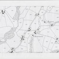
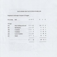
Maps & Data from 1836 : Valuation of Mellor : Damsteads
Dublin Core
Title
Maps & Data from 1836 : Valuation of Mellor : Damsteads
Description
1. Two maps showing the location and area around Damsteads dates : 1880 : 1849
2. Map and typed data taken from 1836 Valuation of Mellor relating to Damsteads Mill, Proprietor R Arkwright, Occupier G Froggatt
3. Valuation map showing Damsteads property, Proprietor R Arkwright, Occupiers Joseph Froggatt, John Froggatt senior, G Froggatt.
Proprietor R Arkwright, Occupier G Froggatt
Date
Reviewed AB 10/2022
Identifier
HOU/03/03
Louiset
Louiset
Collection
Citation
“Maps & Data from 1836 : Valuation of Mellor : Damsteads,” Marple Local History Society Archives, accessed December 4, 2024, https://marplelocalhistorysociety.org.uk/archives/items/show/926.

