MARPLE LOCAL HISTORY SOCIETY, ACCESS TO BRABYNS HALL
PREFACE
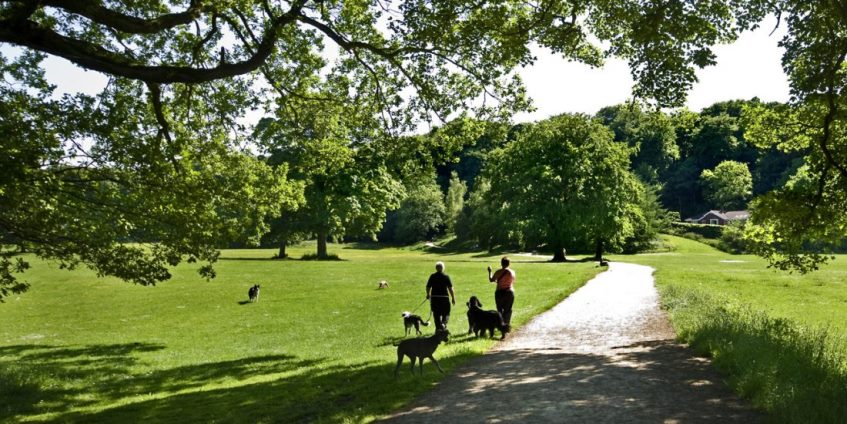
Most members of MLHS will be familiar with Brabyns Park with its recreational meadows, playing fields, riverside and woodland walks, car park (plus a new additional one nearer the river), children’s playground, pond and pets cemetery. Many will have bought various publications at our meetings and will know from these, and society talks, that the Park is named after Brabyns Hall which was a Georgian house built in 1745 by Henry Brabin around a much earlier farm house, and that the most recent incarnation of the Hall was demolished in 1952 after it had been allowed to deteriorate so much that there was no other option. Most members will be aware that they are parking their cars on the site of the hall and the playground area and the pond were part of its garden.
In our walks we often ponder about the history of the paths, narrow and wide, and old gateposts, walls, and an iron bridge. One set of features particularly attracted my attention and inspired me to do some research and write this article for the newsletter.
WHAT INSPIRED THIS ARTICLE
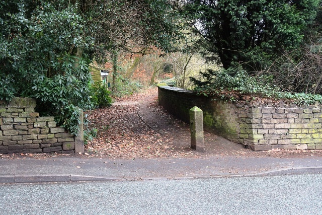
Many times I had walked along the top path from the car park to Brabyns Brow with the wall between the path and pond on my left and was intrigued that when the path was very near the road it was bordered on its right by a much wider path. Emerging onto the pavement and looking back from where I had emerged, there are very old gateposts on the left (as I looked back towards the car park) which, being 9 feet apart, are clearly wide enough apart to accommodate a carriageway, and on the right of the latter, the 4 feet wide path next to the wall, was only wide enough for pedestrians. It was also obvious that most of the footpath was several feet higher than originally due to land slippage as the wall on the footpath side was far lower than on the pond side, and that explains why the assumed carriageway has been totally obliterated. It also follows that the gateposts were considerably taller than they are now as the roadway and footpath and carriageway surfaces are much higher than they used to be.
I was recently re-reading the MLHS Newsletter for January 2024 which has a very helpful article on Brabyns, and the MLHS “Brabyns Hall and Park” - both the 1995 edition by Peter Bardsley and Ann Hearle and the 2013 edition by Ann Hearle which was revised in 2019. The 1995 edition (page 6) reads that between 1811 and 1821 alterations were made to the hall and the estate and “The drive was then diverted to the uphill side of the pond.” I immediately felt that my observations above reflected this statement. It is clear from the portion of the 1811 map in this edition that there was an uninterrupted carriageway (possibly gated at its start, partly along the present day road to the car park, and below the pond excavated between 1811 and 1821), from just above the cottages leading up from the bridge over the river, to the grand front entrance to the Hall which faced down Brabyns Park. This article will present further findings and put them in the context of other access routes to the Hall and Park.
In January this year I discussed these observations with David Burridge, and he offered to come and photograph these observations while I took measurements. The footpath is 4 feet wide and the carriageway 9 feet wide between its gateposts. The wall was typically 4.5 feet high on the footpath side and 8.5 feet wide on the pond side.
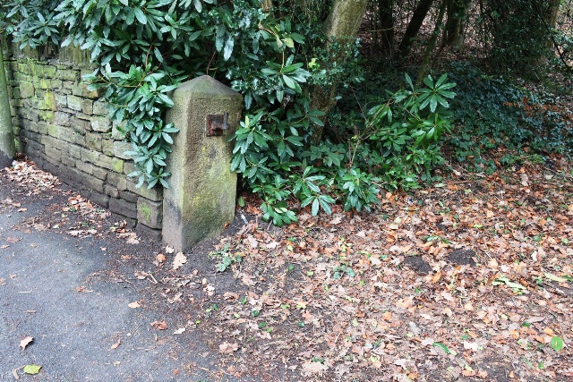
This close up of the carriageway gatepost presumably shows the original upper gatehook. The lower hook will have been below the current ground level and may still be there. The next photograph shows what is left of the carriageway gate latch and at ground level the hook for the pedestrian gate. The stones above it are clearly not original and it is not clear whether the hook is fixed to the top remaining original stone. Whatever that hook’s history it was fixed when the footpath was gated.
The carriageway gate was latched on the freestanding gatepost and hooked on the gatepost adjacent to the wall. The pedestrian gate was latched on the other side of the freestanding gatepost and hooked as discussed above.
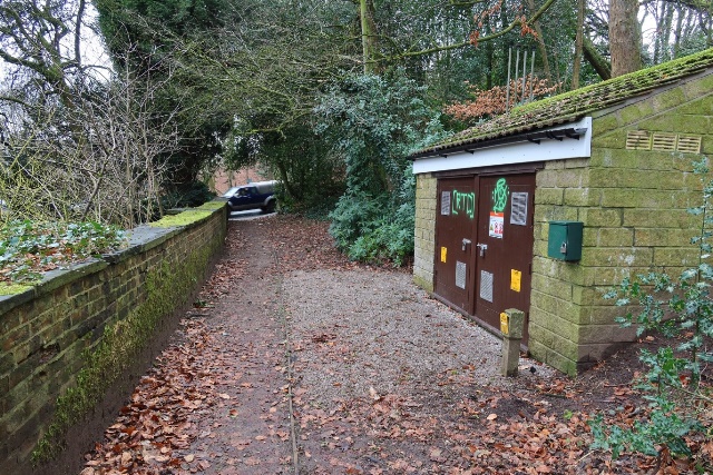
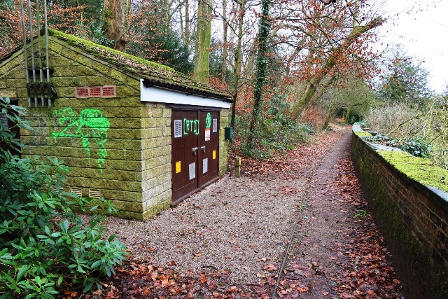
Looking towards the road and towards the car park. The utility building is relatively recent.
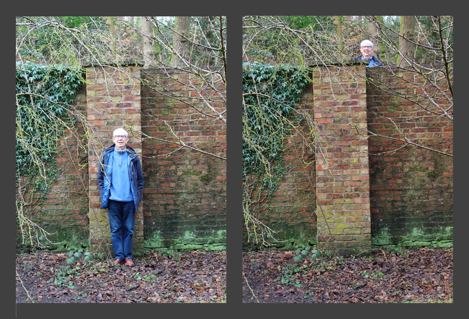
I am here standing on the footpath and garden sides of the wall next to the same wall support.
FURTHER INVESTIGATIONS AND CONCLUSIONS THEREFROM
Judith Wilshaw and Mark Whittaker kindly sent me photos which gave me very useful information about the garden wall as it was decades ago.
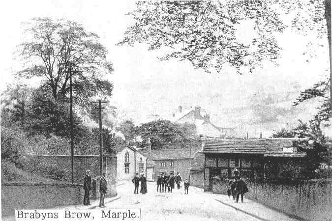
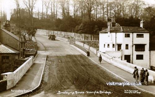
Here, the two men at the left are standing in front of the freestanding gatepost photographed by David. We here see the full height of the wall as it used to be. Furthermore, we see that the high wall turned the corner and continued down the road hence no-one on the garden path or the road would have been able to look into the garden. It could well have been 12 feet high. The timber framed house to the right was demolished when the road was widened in 1930/31.
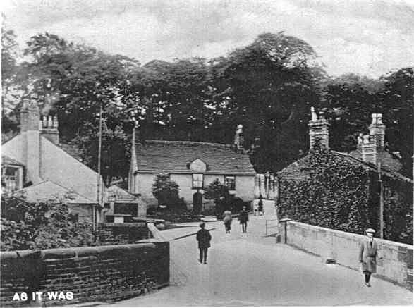
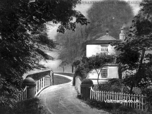
These photos show the scene looking up the bottom of Brabyns Brow from the bridge over the River Goyt before and after the bridge and road were widened. In the “before” photo, the visible part of the road furthest from the viewer is flanked by the high garden wall. The “after” photo portrays the high wall very well. Judith remembers it as a wall when she lived in Marple Bridge as a child (1951-61). It turned the corner and continued along the side of the service road to the farm, stables and Hall, hence keeping the garden private. On the verge of this road was a line of yew trees, some of which still stand and appear to be on the edge of the garden now the wall has been removed.
Returning to the quote “The drive was then diverted to the uphill side of the pond”, I was expecting that when I examined the 1821 map in the MLHS archives in January 2024 it would illustrate this diversion, but did it? I think it shows work in progress. It suggests that the high wall had only reached the northern end of the pond and even then, not far along the path there were two pedestrian accesses 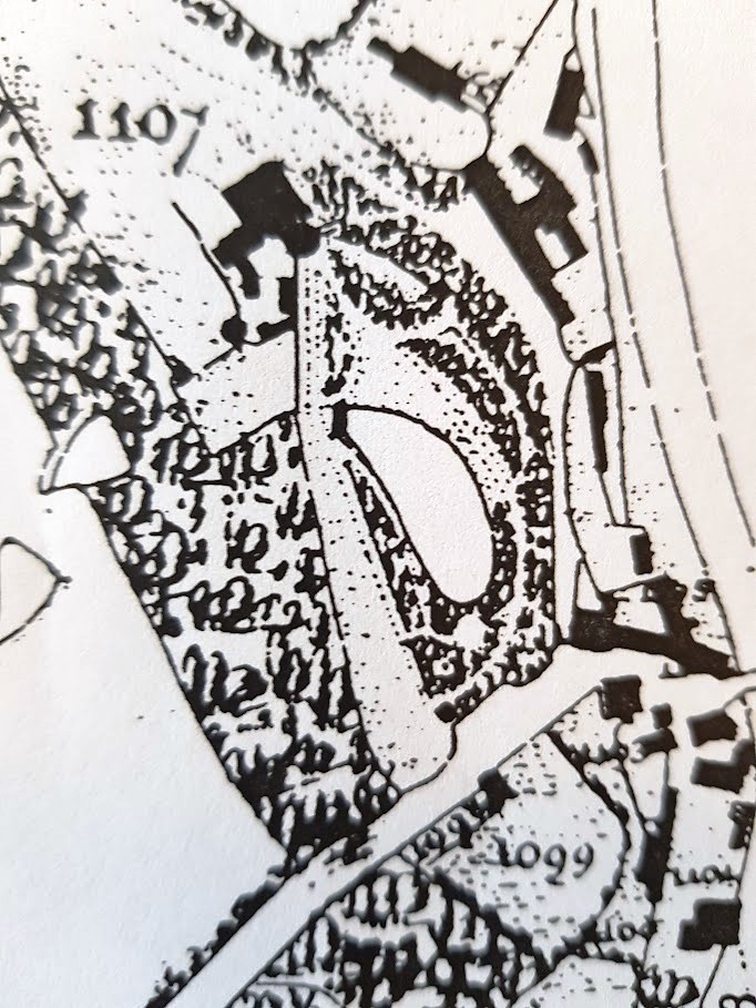 to the garden perhaps related to the practical requirements of the construction workers. From the end of the wall there was access to the garden right up to the new circular dining room. Clearly the residents would not have wanted the hoi polloi to have such access, which explains why there is an outwardly curved wall on Brabyns Brow with a small gap in it presumably with a locked gate supervised by a gatekeeper. Interestingly the drive on the downhill side of the pond gives access both to the stable and coach block as well as to the main entrance to the Hall. That also does not have public access from Low Marple and must have had a gate with gatekeeper permitting access only to approved servants and workpeople as well as the gentlefolk who wanted quick access by foot or on horseback (the entrance gate does not look wide enough for a carriage). At this time of improvements to the Hall and its outbuildings and garden, I guess that the garden wall was soon extended further and that for a while carriages could be driven round the hall in an anticlockwise direction. In later years (see 1896 map) it seems most unlikely that the carriage drive diversion to the uphill side of the pond survived as there was no way through. Probably only the footpath survived by which approved pedestrians could get through to the garden and the front entrance via gateways in walls. While these changes were going on, the 1821 map suggests that the apparent wall on the left-hand side (heading from road to Hall) of the presumably new carriage track and footpath from Brabyns Brow, maintained garden privacy. Peter Bardsley and Ann Hearle did not provide the source for their quote, but my impression is that this diversion was a temporary experiment which became impracticable as further changes to outbuildings and associated small walled enclosures took place. Presumably formal carriage access to the Hall was again dominated by the access through the lodge gates next to the canal (see below). The MLHS Archive team tell me they have ten folders on Brabyns Hall and the website links to these includemuch correspondence in 2013 between Ann Hearle and David Law on the history of the Hall 1650-1920. Perhaps that is where we will find the source for Ann’s statement. Watch this space!
ACCESS FROM BRABYNS BROW IN CONTEXT WITH OTHER ACCESS ROUTES TO HALL AND PARK
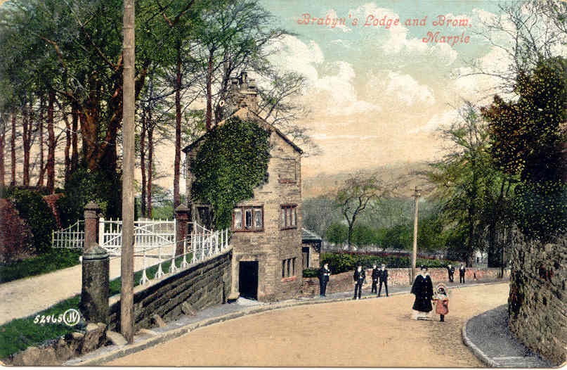
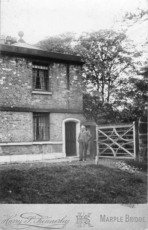
I have referred to carriage access to the Hall being dominated by the access through the lodge gates next to the canal. (The canal locks opened in 1804 and bordered the Brabyns estate.) Most members will be aware of this lodge and Judith has provided me with this wonderful post-card photograph which will date from the very early 1900s. The lodge has changed very little since then but here we can see the gates, access through them being controlled by the lodge keeper.
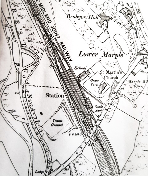
The carriageway descended about a quarter of a mile before looping round to the right making a grand approach to the Hall (built in 1745 by Henry Brabin - which is how he spelt his name - he also built the lodge*) where servants would take charge of carriages and horses. We can still follow the route it took, noting that when the railway was built in 1865, the route was slightly modified to go over its railway bridge. Although we now end up in the car park, we still get beautiful views.
*There is now some doubt as to how far Brabin got with his plans before he died in 1750 as it is known that his widow did not follow through to complete the work. It is very possible that the lodge was built by Nathaniel Wright in the period 1800 - 11.
 The lady walking towards the camera is Mary Moore’s aunt - Daisy Cooke - (see below)
This photograph was one of several donated to MLHS by Mary Moore whose great grandfather farmed Brabyns Hall Farm from 1902 (MLHS Newsletter January 2024). Written on the reverse is: “Aunt Daisy Brabyns Hall grounds pre WW1.” On the left we see the carriageway from the lodge, shortly after it has looped round to its left, merging with that from the Iron Bridge where strolling towards us is Aunt Daisy.
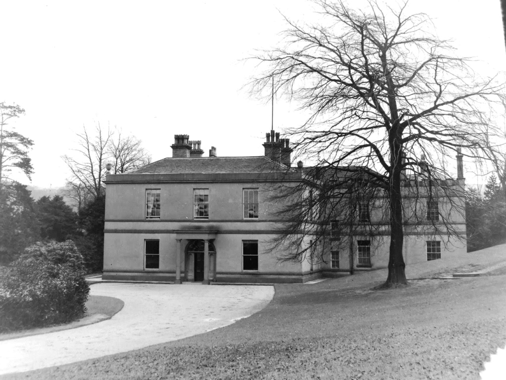
The formal front entrance of Brabyns Hall in the early 20th century.This is the grand destination of the carriageway which started at the Lodge on Brabyns Brow.
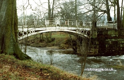
I have discussed the formal route to the front entrance of the Hall was via the carriageway from the lodge, and considered the possible role of potential routes below and above the garden, but there is one other route to the front entrance to be considered, namely access from the Iron Bridge over the river leading to what is now Compstall which was built by George Andrew in the 1820s to house his mill workers (a few years after the Iron Bridge was built).
In the years 1800 - 18, the owner of the Brabyns Estate was Nathaniel Wright. He was succeeded by his son John who was only 18 when his father died in 1818. Nathaniel, employing Salford Iron Works, built the nationally important cast iron bridge over the Goyt in 1813 to serve as a route to his estates on the other side of the river. It is obvious today that there were very wide gates on the Brabyns side of the bridge which were much wider than the bridge. Presumably these were necessary to cope with livestock movements because as the MLHS books discuss, Wright was a noted cattle and pig breeder.
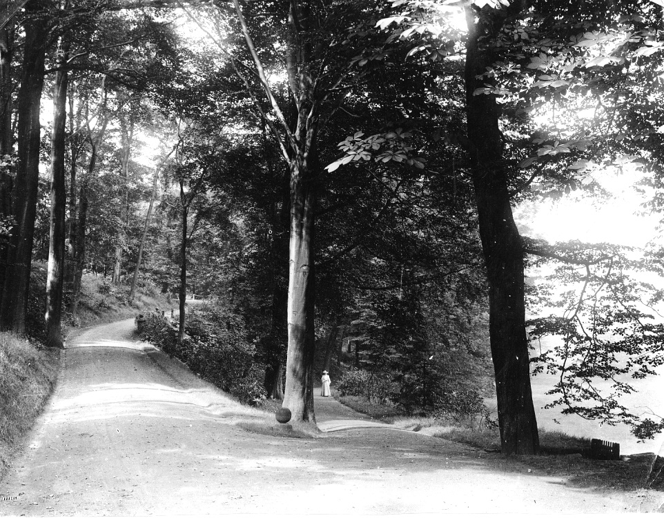
Nathaniel Wright spared no expense in building this elegant bridge, shown in this 1963 photograph, in order to make a fitting entrance to his gentleman’s estate. If he, his family and friends were carrying out business or social engagements on the other side of the river in the Romiley area, it would be so convenient, and status-enhancing to be able to drive or ride over the bridge and along an elegant carriageway leading straight to their front door, rather than the long trek to the lodge on Brabyns Brow.
Although this is a relatively recent photograph, it shows to some degree the impression it would make on visitors to Brabyns Hall in the 19th century.
This wonderful photograph (probably Edwardian) shows that the gatekeeper who lived at the lodge had a door giving him immediate access to the formidable spiked gate. It would not be easy for the “riff-raff” to get past him and his gate! Surprisingly, the carriageway at this time and location looks somewhat scruffy, yet it was considered impressive enough to have it photographed by a professional photographer.
In researching this article, the nature and purpose of the raised track crossing Brabyns Park became obvious. The area still gets wet and boggy after prolonged rain. The Iron Bridge would not only be necessary for the gentry, but it was also important for livestock, farm carts, and estate workers and tradesmen. I guess it was not considered fitting for work people to continue all the way to the Hall. A short distance along the main drive this raised track branches off to the left and heads across towards the river and accesses the farm and farmyard which were situated between the stables and the estate workers cottages at Lower Marple. This track is still regularly used by members of MLHS, ramblers, and dog walkers, especially in wet conditions.
 CONCLUSIONS
What started as my curiosity regarding the origins of the footpath from Brabyns Park car park to Brabyns Brow road has led me to a greater understanding of access to Brabyns Hall over a period of 200 years. Further research in the extensive archives of Marple Local History Society would surely fill in a few missing details. We are lucky to have such a resource and the dedicated team that looks after and manages it.
ACKNOWLEDGEMENTS
A number of people helped me in various ways: taking photographs, providing me with photographs from MLHS Archives and their own collections, giving me the benefit of their own researches and memories, locating documents in the Archives, commenting on and alerting me to errors in early drafts and helping me to improve presentation, and advising me on how to provide our newsletter and website team with appropriate formats for them to carry out their functions. I list these wonderful people in alphabetical order. Hilary Atkinson, David Burridge, Martin Cruikshank, Neil Mullineux, Mark Whittaker and Judith Wilshaw.
